Finding PJ2T - Jeff Maass, K8ND
The coordinates are: 12 deg 15.677' N, 69 deg 7.408' W (or, 12.2613 deg N, 69.1235 deg W).
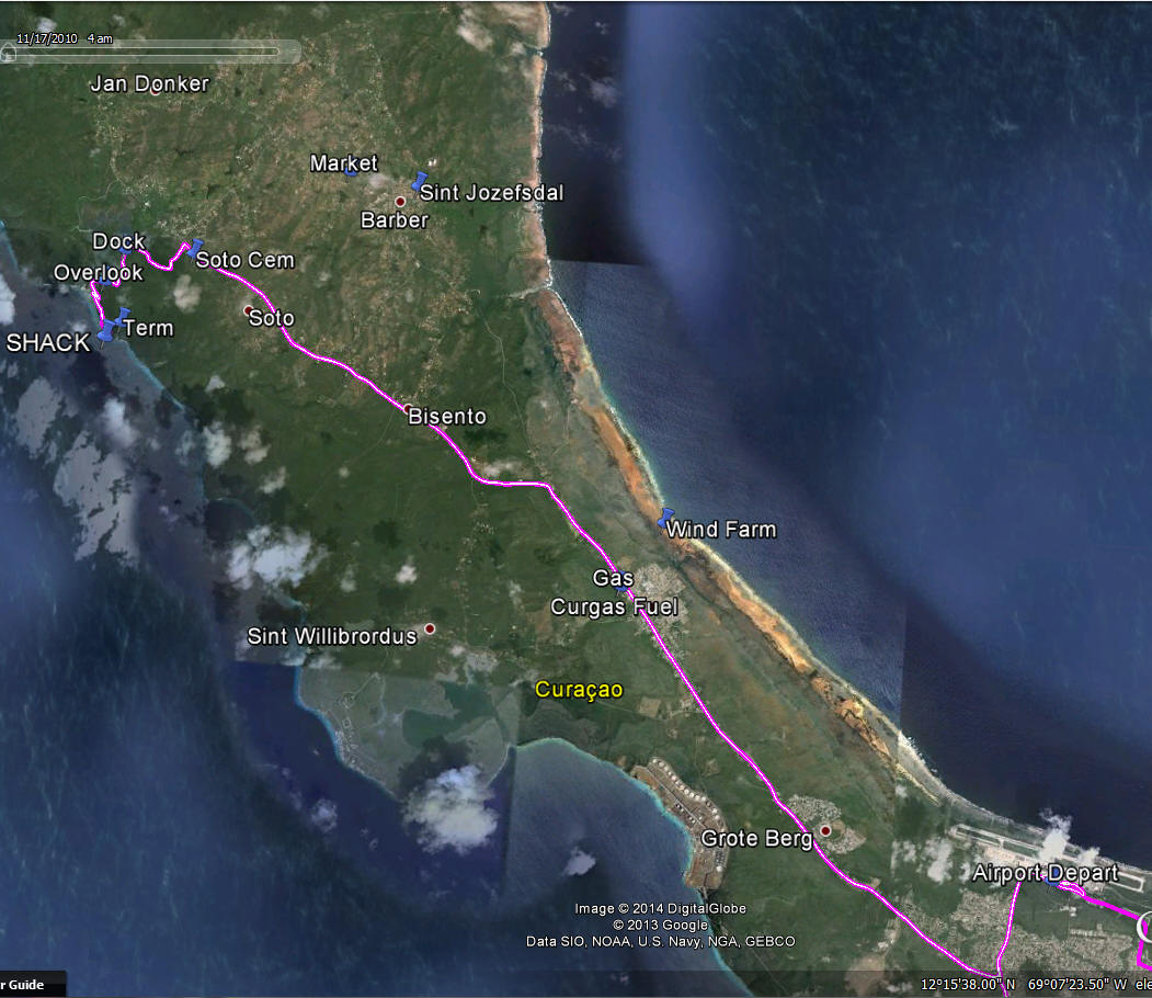
The short-form directions are: Turn right at the airport exit and follow the signs toward Westpunt. Be especially certain to make the right turn at the big traffic circle that you will reach a couple of minutes after leaving the airport. Follow the signs toward Westpunt. The road is "Weg Naar Westpunt", and is the only major road to the West end of the island. Just past the wind power generators on the right, there is a Y-turn toward the village of Soto; turn left toward Soto. When you reach Soto, just beyond the cemetery and church and school on the left is a left turn. Turn left and follow it past Landhuis Groot Santa Marta (on the right) and stay on the mostly-paved road until you reach the former Sunset Waters Beach Resort grounds. Follow the road winding down the hill (beware the aggressive speed bumps!), and turn left when you see the hotel buildings. Follow the narrow road that runs parallel to the hotel buildings and the shoreline, and note that you can see the towers soon thereafter ahead of you: we are about 1/2 miles from the old hotel. Park outside the side wall facing the ocean. Travel time from the airport or Willemstad is 35 to 40 minutes, more during morning and afternoon rush.
Below is Google Earth screen capture showing a GPS track to the station. For reference, the airport is at the bottom-right, and the station is at top-left ("SHACK"). Willemstad is off-image to the bottom right.